
.png)
Aerial Photography and Videography
Cinematic aerial imagery and video captured from above. From real estate and commercial marketing to project documentation and site overviews, we deliver professional visual content that ground-based photography simply cannot match.
RAW
Photo
Formats
4K
Video
Resolution
48HR
Turnaround
Licensed
RPAS
Operator
- USE CASES
Where We Work
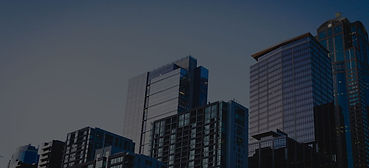
Internal inspection of oil, chemical, and water storage tanks. Corrosion mapping, weld inspection, and floor assessment without confined space entry permits.
Real Estate Marketing

Cinematic aerial footage for project marketing, investor presentations, and stakeholder communications. Show the scale and progress of your development from above.
Construction and Development

Facility overviews, site documentation, and marketing content for commercial properties, industrial campuses, and infrastructure assets.
Commercial and Industrial
- WHAT YOU RECEIVE
Deliverables
Every shoot is delivered in professional formats ready for immediate use across marketing, documentation, and presentation materials.
-
4K aerial video footage, edited and colour graded
-
High-resolution aerial stills in JPEG and RAW
-
Wide establishing shots and detailed close-ups
-
Vertical and horizontal formats for social and web
-
Before and after visual comparisons where applicable
-
Secure cloud delivery of all raw and edited files
-
Licensed for commercial use

High-quality visual records of projects for portfolios, award submissions, case studies, and ongoing marketing use.
Project Documentation

- WHY AERIAL IMAGERY
A perspective that changes everything.
Aerial photography and videography does not replace ground-based media, but rather complements it perfectly. By adding context, scale, and environment in a single frame, it delivers a unique dimension that ground cameras cannot replicate on their own. We work directly with professional photographers and videographers to seamlessly integrate these perspectives and help elevate your brand.
Context and Scale
Aerial imagery shows the full picture. A property's relationship to its surroundings, a site's scale, and the environment it sits within are all captured in a single frame that ground-based photography misses entirely.
Professional Quality
Every shoot is flown by a licensed RPAS operator using professional-grade equipment. 4K video and high-resolution stills delivered in formats ready for immediate commercial use.
Fast and Flexible
Our LiDAR-capable platforms deliver accurate spatial measurements, 4K video, and high-resolution photography in a single flight. More detail than a manual inspection, and a permanent record of your asset's condition.